
Summary
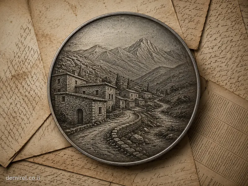
Kohneh Shahr (Persian: کهنهشهر; also written Kohneshahr, Kuhneh Shahr and Kohneh Shar) was a historic settlement in the Salmas Plain of northwestern Iran, in present-day West Azerbaijan Province. Its Persian name literally means “Old City” or “Old Town.” Following the catastrophic earthquake of 1930, the settlement was rebuilt or replaced by Tazeh Shahr (تازهشهر, “New City”).[1][3]
Location and relation to Salmas and Dilman
For the period before the 1930 earthquake it is important to distinguish between the names Salmas, Dilman and Kohneh Shahr. Salmas was long used as the name of the district and plain containing numerous settlements. By the late nineteenth and early twentieth centuries, the principal urban and administrative centre of the district was Dilman, also written Dilmaqan or Dilmaghan. A contemporary Armenian account from around 1900 explicitly identifies Dilman as the capital of the Salmas district.[4][5]
Kohneh Shahr was a separate settlement from Dilman, not another name for it. Iranian historical literature cited in the history of Salmas places Kohneh Shahr one farsakh from Dilmaqan. It lay southwest of Dilman, in the southwestern part of the Salmas Plain.[2]
Modern Tazeh Shahr, identified with historical Kohneh Shahr, lies at approximately 38.1756° N, 44.6919° E, southwest of the modern city of Salmas. Consequently, references to Kohneh Shahr in nineteenth- and early twentieth-century documents should not automatically be interpreted as references to Dilman or to the present city of Salmas.[3][6]
Kohneh Shahr and ancient Salmas
The name Kohneh Shahr, meaning “Old City,” reflects the antiquity associated with the settlement. The major study of the 1930 earthquake describes it as a place of considerable antiquity. Until the earthquake it contained important older structures, including a great mosque and the medieval brick tower known as the Miri Khatun Tower.[1]
Some Iranian historical scholarship has proposed that Kohneh Shahr occupied the site of the older city of Salmas mentioned by medieval Muslim geographers and historians. Habib Zahedi argued that much of the early historical material concerning the city of Salmas actually relates to the settlement later known as Kohneh Shahr. According to this interpretation, the old centre declined during the Qajar period while nearby Dilmaqan developed into the main urban centre of the district.[2]
This identification should nevertheless be treated with caution. “Salmas” was also a regional name throughout much of its history, whereas by the early twentieth century Kohneh Shahr and Dilman were unquestionably two distinct settlements. Historical references to “Salmas” must therefore be interpreted according to context: they may refer to the district or plain, to Dilman as its administrative centre, or to another locality within the region.
The settlement before the earthquake
The detailed field study by seismologists J. S. Tchalenko and Manuel Berberian, based on field investigation, survivor testimony and contemporary written material, estimated the population of Kohneh Shahr in 1930 at approximately 2,290 inhabitants. Dilman, by comparison, was the largest settlement in the region, with an estimated population of about 18,000.[1]
Kohneh Shahr formed part of the ethnically and religiously diverse settlement system of the Salmas Plain, where Muslim communities lived alongside Armenian, Assyrian and Chaldean Christian communities. The earthquake survey records five church buildings destroyed in Kohneh Shahr, as well as the great mosque and other structures. These remains illustrate the multi-community history of the wider area, although they do not by themselves establish the exact demographic composition of the town at any particular date.[1][4]
The 1930 earthquake
On 6 May 1930 a strong foreshock struck the Salmas Plain, damaging buildings and prompting a large part of the population to spend the following night outdoors. The main shock occurred at 22:34 GMT on 6 May, corresponding to the early hours of 7 May local time in Iran. It was one of the major destructive Iranian earthquakes of the twentieth century, destroying roughly sixty settlements and dozens of churches in the Salmas Plain and surrounding mountains.[1]
Kohneh Shahr stood close to the zone of greatest destruction. Tchalenko and Berberian define an area bounded approximately by Kohneh Shahr, Payajuk and Zaviehjuk as the zone of maximum devastation. Kohneh Shahr itself was destroyed. Their table gives an estimated 370 deaths among a population of about 2,290. The authors caution, however, that casualty figures for the larger settlements, particularly Dilman and to a lesser extent Kohneh Shahr, cannot be regarded as completely reliable.[1]
Among the buildings destroyed were the great mosque and the medieval brick Miri Khatun Tower. Iranian sources date the tower to around 700 AH, approximately the late thirteenth or early fourteenth century, and associate its construction with Miri Khatun, daughter of Arghun Aqa. These monuments demonstrate the historical importance of Kohneh Shahr long before the modern period.[1][3]
After the earthquake
Following the disaster, Kohneh Shahr ceased to exist in its former form and was rebuilt or succeeded by Tazeh Shahr, literally “New City.” The earthquake study explicitly describes Kohneh Shahr as having been replaced after the earthquake by Tazeh Shahr, while Iranian geographical sources identify present-day Tazeh Shahr with the former Kohneh Shahr.[1][3][6]
Dilman was also destroyed, but followed a different path of reconstruction. A new town was built west of the ruins of Dilman and named Shahpur. After the Iranian Revolution its official name became Salmas. This is a major source of modern confusion: present-day Salmas is primarily the urban successor of Dilman, whereas historical Kohneh Shahr corresponds to nearby Tazeh Shahr.[1][2][4]
Sources
- J. S. Tchalenko and M. Berberian, “The Salmas (Iran) Earthquake of May 6th, 1930,” Annals of Geophysics, Vol. 27, Nos. 1–2, 1974, pp. 151–212.
- “Salmas” (سلماس), Persian Wikipedia, historical section, citing Habib Zahedi and Iranian historical-geographical literature concerning Dilmaqan and Kohneh Shahr.
- “Tazeh Shahr” (تازهشهر), Persian Wikipedia, citing Farhang-e Joghrafia’i-ye Iran and Iranian encyclopedic sources.
- “Armenians of Modern Iran,” Encyclopaedia Iranica.
- Samvel Karapetian, History of Armenia: Salmast, Vol. 2, Yerevan, 2019; historical material reproduced by the Armenian Architecture / Armenian Historical Monuments database.
- Ali-Akbar Dehkhoda, Dehkhoda Dictionary, entry “Tazeh Shahr,” based on Farhang-e Joghrafia’i-ye Iran, Vol. 4.
Names and spelling variants
Kohneh Shahr; Kohna Shahr; “the old city”; Kuhna Shahr
Mentioned in the book
Chapter One – Salmas; segment 01.01 – Salmas; Chapter Three – Wanderings; segment 03.01 – The Return to Kuhna Shahr; Chapter Three – Wanderings; segment 03.03 – Dilman; Chapter Six – Epilogue; segment 06.01 – Epilogue