
A reconstructed map of the Salmas Plain, Kohneh Shahr, Dilman and the surrounding settlements, based on a comparison of historical maps and sources from the nineteenth and early twentieth centuries.
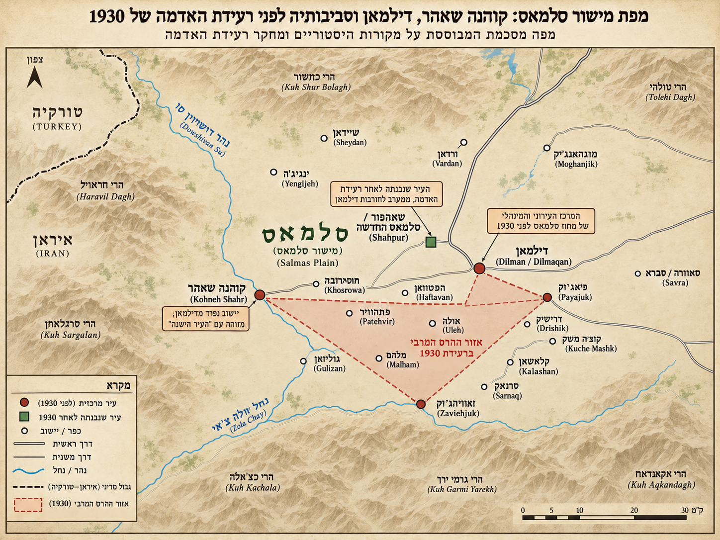
This is a modern reconstruction intended to illustrate the spatial relationships between the settlements. It is not a copy of a single historical map, but a synthesis and cross-checking of cartographic and historical sources.
Maps and Cartographic Sources Used for the Reconstruction
- J. S. Tchalenko & M. Berberian, ‘The Salmas (Iran) Earthquake of May 6th, 1930’ (1974) - particularly Figures 2 and 3, which map the Salmas Plain in detail, including Dilman, Kohneh Shahr, Khosrowa, Haftavan, Payajuk, Zaviehjuk and many other settlements, roads, waterways and zones of destruction.
- DİLMAN - historical topographic map dated 1930, scale 1:200,000, Harita Umum Müdürlüğü; digital collection of the Grand National Assembly of Turkey (TBMM).
- Samvel Karapetian, History of Armenia: Salmast, Vol. 2 (Yerevan, 2019) - historical and cartographic material on Salmast, including an early twentieth-century manuscript map of the region.
- Country of the Nestorians and Regions Adjacent - folding map accompanying Thomas Laurie, Dr. Grant and the Mountain Nestorians (Boston, 1853).
- Sidney E. Morse, Country of the Nestorians (1848), The Cerographic Missionary Atlas, scale 1:2,100,000; David Rumsey Historical Map Collection.
- British War Office, Tabríz Sheet, Carte internationale du monde au 1,000,000 E (1931), scale 1:1,000,000 - a map produced immediately after the 1930 earthquake.